The Cardo is the excavated remains of the main commercial street of Byzantine Jerusalem, built by Emperor Justinian in the 6th century CE and now partially restored in the Jewish Quarter. The word “cardo” means “hinge” in Latin, the central axis around which a Roman or Byzantine city was organized. Jerusalem’s Cardo ran from the Damascus Gate in the north to the area of the present-day Jewish Quarter in the south, a distance of about 900 meters.
Hadrian’s Cardo and Aelia Capitolina
The Cardo visible today is the Byzantine street, but it was built over an earlier Roman predecessor. When Emperor Hadrian rebuilt Jerusalem as the pagan city of Aelia Capitolina after the Bar Kokhba Revolt in 135 CE, he laid out the city on a classic Roman grid plan with a main north-south colonnaded street running from the Damascus Gate southward. This was the original Cardo of Aelia Capitolina. The 6th-century Madaba Map, a mosaic floor map of the Holy Land found in a church in Jordan, clearly shows the colonnaded street running the full length of the city from the Damascus Gate. When Justinian extended the Cardo southward in the Byzantine period, he was expanding on Hadrian’s earlier Roman layout. Today, visitors can see the excavated column bases of the Byzantine extension in the Jewish Quarter, while the northern section of Hadrian’s original Cardo lies beneath the markets of the Muslim Quarter, still serving as a main street after nearly two thousand years.
Byzantine Street
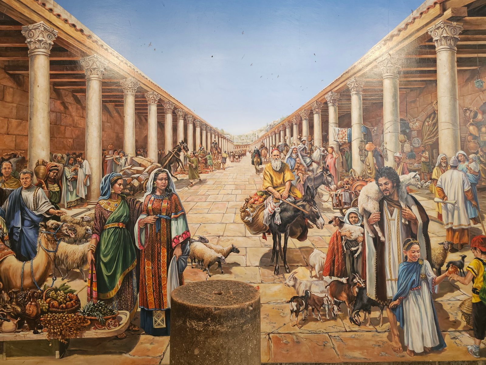
Justinian’s Cardo was 22 meters wide, lined with covered colonnades on both sides that sheltered shops and pedestrians from sun and rain. The Madaba Map depicts the Cardo running the full length of the city as a broad colonnaded avenue. The excavated section in the Jewish Quarter preserves several of the original columns, the paving stones, and the foundations of the shops that lined the street.
Reconstructed and Restored
The restored section of the Cardo has been integrated into the modern Jewish Quarter as a shopping arcade. Modern shops and galleries occupy the spaces where Byzantine merchants once sold their goods, and the combination of ancient columns and contemporary commerce creates one of the most distinctive shopping experiences in Jerusalem. A large reproduction of the Madaba Map is displayed at the entrance, showing visitors exactly where they are standing in relation to the 6th-century city.
The Crusaders extended the Cardo southward and built a covered market along its route, parts of which survive in the vaulted spaces of the current market. The transition from Byzantine columns to Crusader vaults to modern shops, all in the same street, is a physical timeline of Jerusalem’s commercial history spanning 1,500 years.
Visit with Hoshen Tours
The Cardo is one of the most striking archaeological sites in the Jewish Quarter, and walking its ancient stones with a guide brings Byzantine Jerusalem to life. Your Hoshen Tours guide will connect the Cardo to nearby treasures like the Broad Wall from the First Temple period, the towering Hurva Synagogue, and the remains of the Nea Church commissioned by Emperor Justinian. The Cardo leads naturally toward the Western Wall plaza, creating a seamless journey through the ages.
Explore Our Tour Collection
Explore this site and 65 more in Sacred Steps in the Holy Land
225 pages · The Life, World, and Footsteps of Jesus · Maps, photos, and Scripture references
Ready to experience Israel in true colors?
Plan Your TourPrivate tours designed around your interests, schedule, and pace.